Daniel Swain Quoted in Redding Record Searchlight: Historic ‘Bomb Cyclone’ Crashes into Coast, Sending Rain and Snow Shock Waves Inland
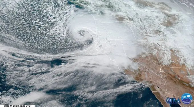
Daniel Swain, a climate scientist at UCLA and author of the Weather West blog, posted a satellite image of the cyclone and tweeted admiringly of it. “Gorgeous GOES-17 imagery depicting explosively deepening…
Daniel Swain, a climate scientist at UCLA and author of the Weather West blog, posted a satellite image of the cyclone and tweeted admiringly of it.
“Gorgeous GOES-17 imagery depicting explosively deepening surface low (“#BombCyclone”) approaching West Coast near OR/CA border. Storm is generating hurricane-force winds offshore & gusts to 70 mph along coast, as well as widespread lower elevation snow in OR & N. CA,” Swain tweeted.