
Laboratory for Environmental Narrative Strategies

PerSquareMile
A tool for identifying high impact park, open space, and conservation projects in California.
PerSquareMile Access and Conservation Opportunity Areas
About the Tool
The PerSquareMile tool was created to identify areas where new parks and access to nature could have the greatest impact in serving the most people who currently lack access to nearby nature in California. It was developed by Jon Christensen and Zoe Frumin at the UCLA Institute of the Environment and Sustainability with GreenInfo Network.
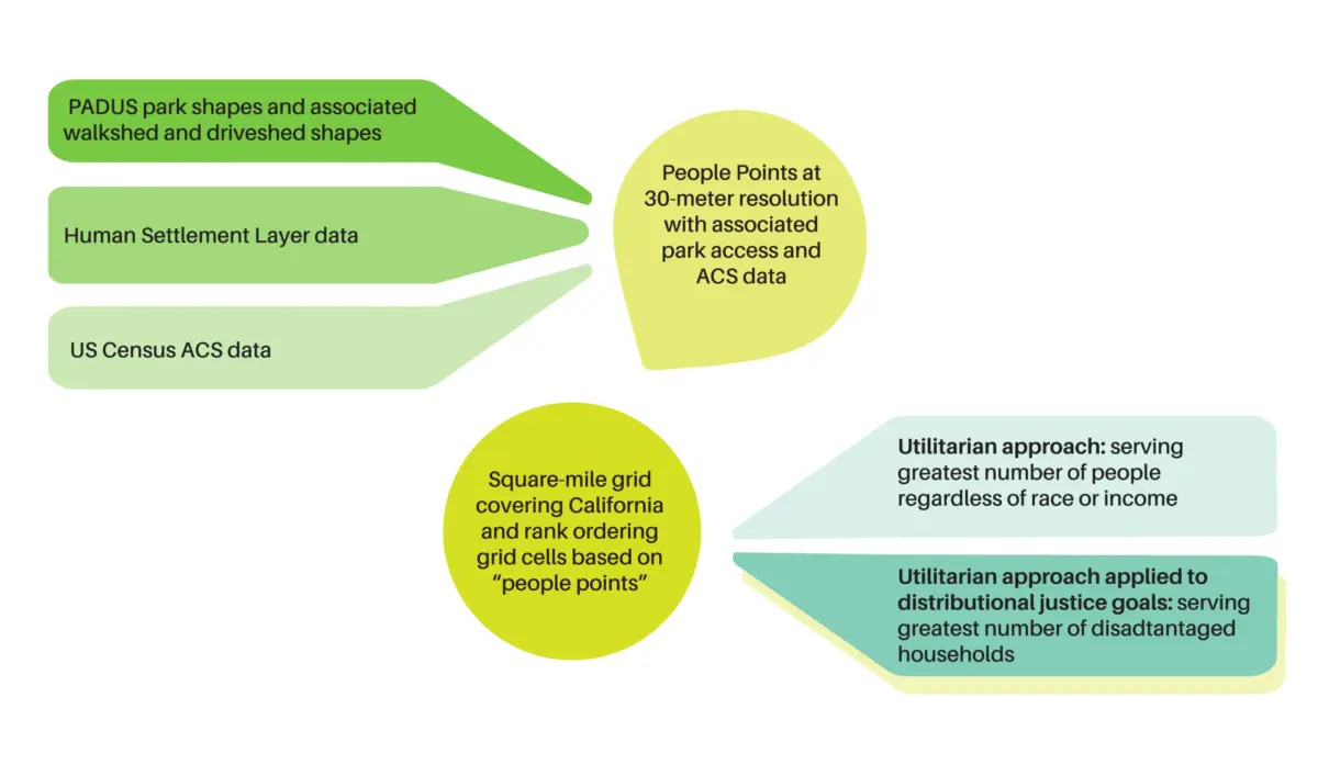
The tool starts by laying a one-square-mile grid across the state of California. It then uses high-resolution population location data to count how many people live in each square mile of the state. It then adds parks and open space locations, demographic data, biodiversity metrics, and other environmental data to identify specific areas where investments in parks and natural areas could serve the most people in need and provide other benefits, such as restoration and conservation for other species.
The PerSquareMile tool is essentially a utilitarian tool. It enables prioritizing the greatest good for the greatest number of people most efficiently. But it can also be coupled with other data to help achieve distributional justice goals, serving populations with the greatest need. And it can help achieve conservation goals, where areas with potential for restoring and protecting habitat for other species could co-exist with appropriate access to nearby nature for people to enjoy the benefits that time spent in nature provides for human health and well-being.
PerSquareMile in Action
Los Angeles City Park Needs Assessment
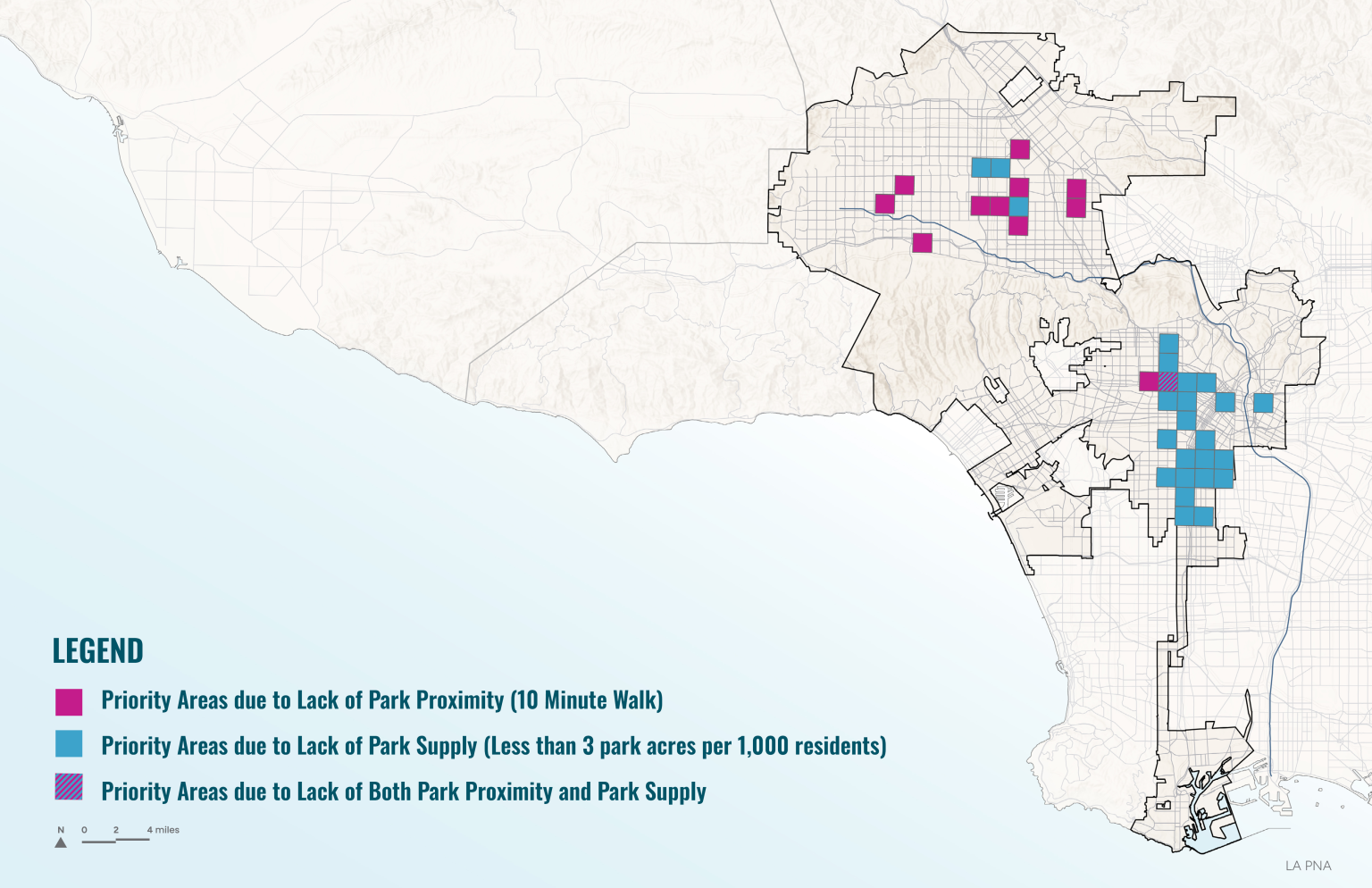
The City of Los Angeles Department of Recreation and Parks used the PerSquareMile tool in the city’s 2025 Park Needs Assessment (PNA) to identify priority areas for park investment.
The tool narrowed in on square-mile grids with low park access (a high number of people without a park within a 10-minute walk of their homes) as well as low park supply (areas where there are less than 3 park acres per thousand people.)
PerSquareMile Components
Questions? Comments? Ideas?
We want to hear from you! Please reach out to Jon Christensen with any questions and comments on how to use the PerSquareMile tool in your work.
Jon Christensen, Adjunct Assistant Professor
UCLA Institute of the Environment and Sustainability
Director, Laboratory for Environmental Narrative Strategies
mobile: 650-759-6534 | email: jonchristensen@ioes.ucla.edu
christensenlab.net