Daniel Swain in KXAN NBC: ‘Smoke cyclone:’ Airborne ash from California fires creates disturbing satellite image
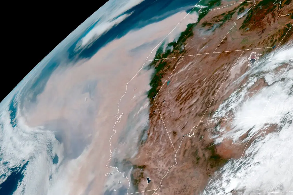
For the better part of a month, fires from across the western United States have filled the skies with smoke and ash, creating unhealthy air conditions for millions of Americans. …
For the better part of a month, fires from across the western United States have filled the skies with smoke and ash, creating unhealthy air conditions for millions of Americans. Daniel Swain, a climate scientist, spotted a plume of ash on Wednesday reaching the mid-level of the atmosphere and swirling in a cyclone-like movement above California. This is a meteorological feature he doesn’t think he’s seen before.