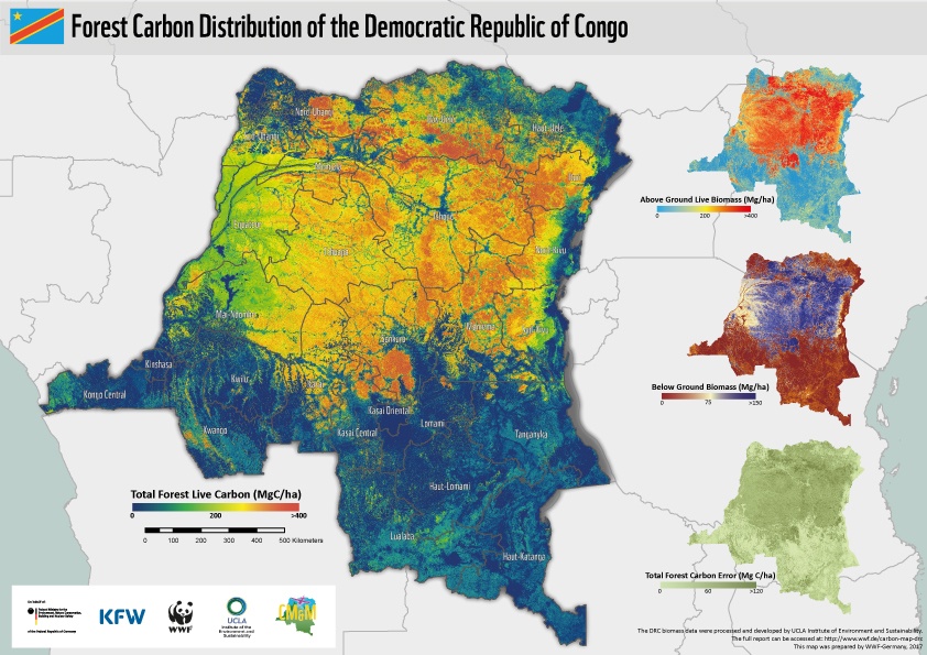
New carbon map will help protect the DRC’s rainforests
Researchers were able to map the aboveground biomass in the DRC down to the one-hectare level using high-resolution airborne Light Detection and Ranging, or LiDAR, in combination with satellite imagery and machine learning geospatial algorithms, a method developed by Dr. Sassan Saatchi, an expert on tropical forests and the global carbon cycle at UCLA’s Institute of the Environment and Sustainability and NASA’s Jet Propulsion Laboratory.
Researchers were able to map the aboveground biomass in the DRC down to the one-hectare level using high-resolution airborne Light Detection and Ranging, or LiDAR, in combination with satellite imagery and machine learning geospatial algorithms, a method developed by Dr. Sassan Saatchi, an expert on tropical forests and the global carbon cycle at UCLA’s Institute of the Environment and Sustainability and NASA’s Jet Propulsion Laboratory.