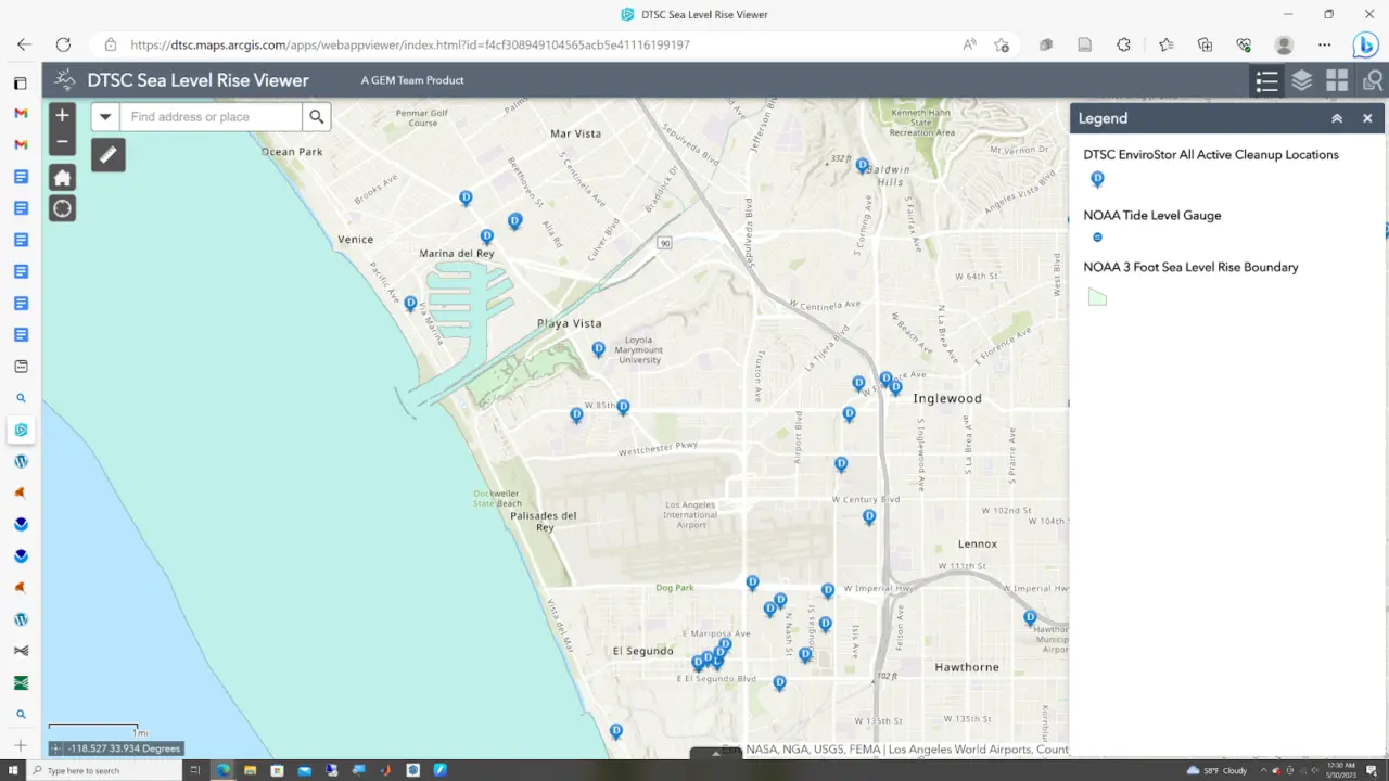
The DTSC Sea Level Rise Viewer allows users to view projected sea level rise boundaries and the locations of active cleanups (Sources: DTSC, NOAA).
With her dissertation research, Peggy will be supporting DTSC’s refinement of their sea level rise guidance for project managers by applying her mathematical modeling, research, and GIS skills to evaluate sea level rise impacts on coastal contamination clean up sites and legacy pollution. D.Env alumnus Todd Sax is serving as Peggy’s residency advisor.
DTSC Sea Level Rise Guidance for Project Managers