Finding climate answers through a Sierra Nevada haze
A new study shows that temperatures in the Sierra Nevada could rise up to 10 degrees, threatening ecosystems, California’s water supply—and increasing the risk of wildfires.
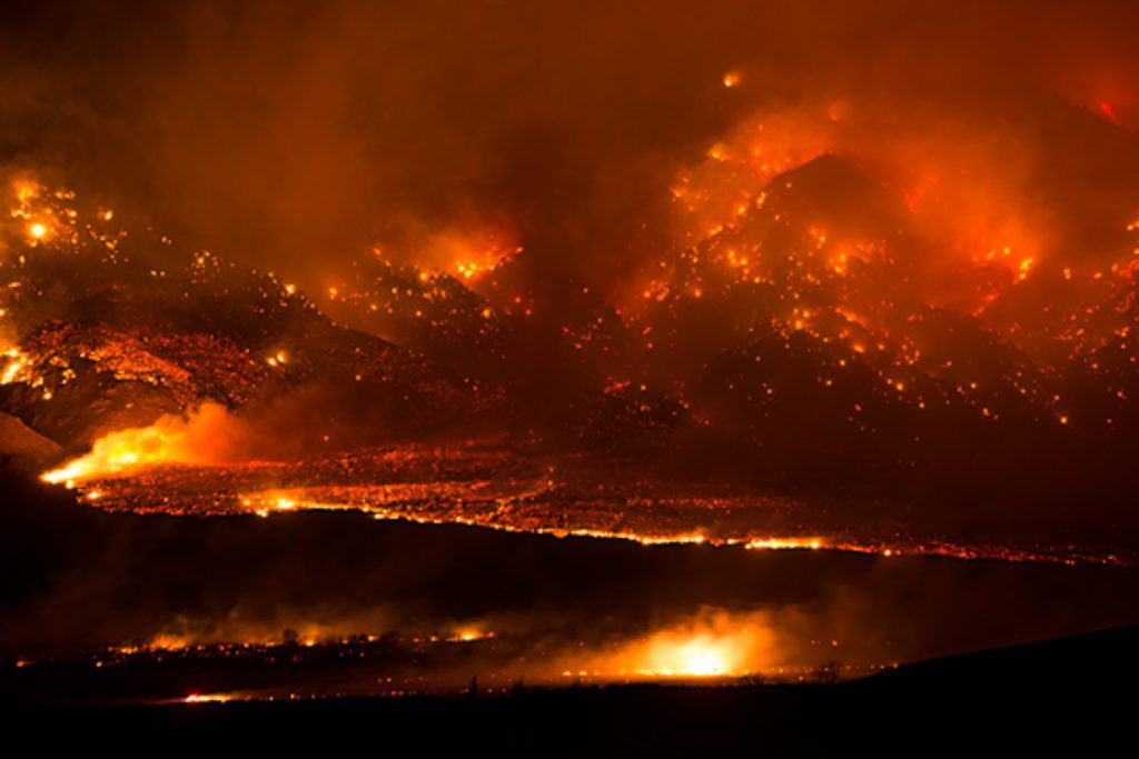
There was still smoke in the air when UCLA ecologist Jeff Holmquist returned to his hometown of Swall Meadows, California, on the morning of February 7, 2015.
Powered by winds of 70 miles per hour, a sudden, fast-moving wildfire ravaged the high desert community, blowing up to 7,000 acres in a matter of hours. Holmquist congregated with somber neighbors along the edge of town, bracing for the worst.
“It was the scene we see playing out on the small screen so many times,” he said. Some wanted to be alone. Others were crying with friends and family. Holmquist saw unburnt houses through the haze, but not his own. Later that afternoon, he received news that his home was one of 40 destroyed by the Round Fire.
The blaze started when a downed power line ignited dry shrubs. During most Februaries, snow cover would have quickly extinguished the flames—Swall Meadows is 6,300 feet above sea level in the eastern Sierra Nevada. But because of the historic statewide drought and high temperatures, the soil wasn’t even moist.
Such conditions could become the new normal if nothing is done to curb greenhouse gas emissions, according to a new study in the Journal of Climate. By the end of the century, average temperatures in the region are projected to soar by up to 10 degrees. In the month of April, snow covered areas would shrink by 48 percent.
Increased temperatures and snow loss were examined together because of the albedo effect, said Alex Hall, a UCLA professor and co-author of the study: Light-colored snow reflects the sun’s rays away from Earth. When it melts, the darker surfaces beneath absorb more radiation and heat, forming a vicious circle that accelerates both warming and snowmelt. His study is the most comprehensive to incorporate the phenomenon in climate projections for the Sierra.
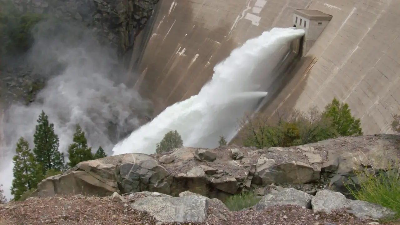
Increased wildfires are only one concern with rising temperatures. They also threaten ecosystems and endanger more than half of California’s already-tight water supply.
“The snow is a natural reservoir of water,” Hall said. “Human-created reservoirs that line the Sierra are sized assuming it will still exist.” Were the snowpack to dramatically reduce or disappear, Hall said, those reservoirs are probably not engineered to collect the water that falls.
Hall, lead author Daniel Walton and their fellow researchers made their projections using a process called downscaling, which uses large-scale information to make predictions at a local level. Specifically, they used hybrid downscaling, a method they pioneered at UCLA. It combines statistical downscaling (which uses simple mathematical models to relate large-scale data values to smaller-scale values) with dynamical downscaling (which uses complex computer models to simulate local conditions in greater spatial detail).
Global climate models are the main tool used to simulate the world’s climate, using numerical computer simulations to predict future changes. But global models are operated at a very low resolution, so they’re ineffective at predicting climate at a local or even regional level. Hybrid downscaling compiles global model outcomes to account for variations, taking into account geographic characteristics that influence local climate.
The Hall team ran a set of dynamical downscaling simulations using the Hoffman Cluster, a UCLA supercomputer, over the course of several months. They then worked with those simulations to understand the physical reasons for the projected changes, and built a statistical model to capture real-world conditions.
The technique can also be used to predict outcomes based on different sets of circumstances—if carbon emissions were substantially reduced or mitigated, for example. Hall’s team found that under a “mitigation” scenario, warming and snow cover loss still occur but are less severe.
“We can be very specific about the benefits of reducing greenhouse gases by the end of the century,” Hall said. The projections can also help decision makers develop plans and infrastructure to account for the expected changes.
Up in Swall Meadows, Jeff Holmquist is rebuilding his house in the same location, which has spectacular views into the valley and is home to copious deer, mountain lions, foxes, golden eagles and more.
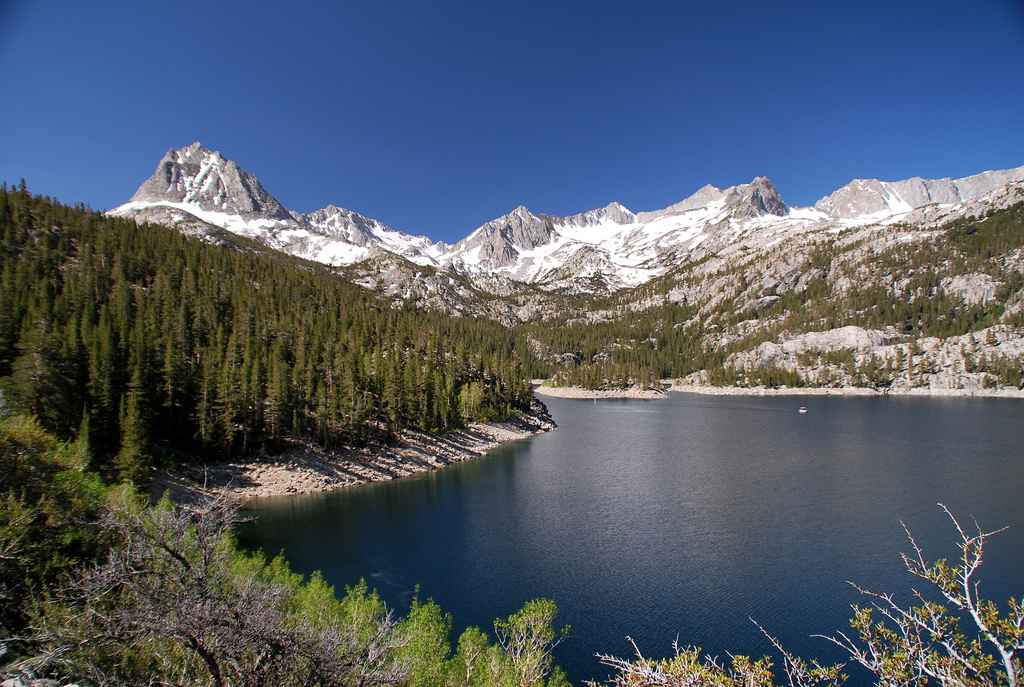
That natural grandeur is one reason Hall decided to focus on the Sierra Nevada.
“It’s a region that represents the best and worst in environmental planning and practices,” Hall said. “It’s a resource that’s completely exploited in the sense that we take all of the water and use it for our own purposes.
“On the other hand, the Sierras are this iconic landscape. You can argue the conservation movement in the United States was basically launched through an effort to protect the Sierra Nevada—an effort to protect these amazing places.”
The study is the first in a series that will examine the Sierra Nevada’s climate future, culminating in a public report that will synthesize findings and discuss implications for planning and human adaptation.
Hall said he enjoys the challenge of learning how climate change plays out on scales that are familiar to people. The methods his research group is continually refining can be repurposed with changes for other parts of the world—the Colorado River Basin, Alps or Himalayas, for example.
He sees California as the ideal place to incubate scientific methods, public policy and practices.
“California’s ability to adapt is great because we’re a wealthy state,” Hall said. “We need to develop these techniques to the point where they can be applied efficiently and easily anywhere, so not just the wealthy parts of the world can benefit from having climate change adaptation science.”