River in the sky to hit northern California with major precipitation
A subtropical mega storm will bring much needed precipitation to California this weekend. However, its warm temperatures and rain could melt Sierra Nevada snow pack and cause flooding.
Another round of much needed rain and snow is headed towards our drought-parched state this weekend, with double-digit rainfall totals expected in the coastal mountains and Sierra Nevada.
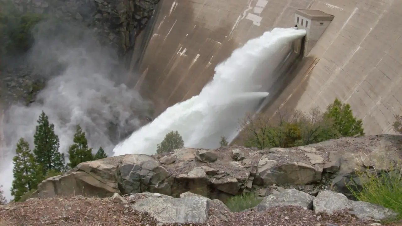
But there’s a catch—this storm has origins in the subtropics. That means relatively warm temperatures will bring rain rather than snow for a good portion of the weekend, even at very high elevations. This rain, combined with melting snow, could lead to serious flooding in some places.
If you follow weather news, you may recently have heard talk about “atmospheric rivers,” the source of this weekend’s weather woes and a primary focus of my research at UCLA. So what’s the deal with these immensely important, yet mysterious sounding plumes of water? Here’s the scoop.
What is an “atmospheric river” exactly?
Atmospheric rivers are a type of weather phenomenon characterized by long, narrow plumes of highly concentrated water vapor. Just as land-based rivers flow downstream in well-defined channels of rock and soil, atmospheric rivers transport huge volumes of water vapor through the air in winding pathways defined by the course of high-altitude winds. In fact, the strongest ones extend over thousands of miles and are capable of transporting ten times as much water as the Mississippi River holds. These rivers aren’t unique to California, occurring throughout Earth’s temperate latitudes and usually originating over oceans.
How does the atmospheric river that’s headed for California right now look?
This one is particularly intense and slow-moving. It’s currently expected to affect much of northern and central California this weekend, between Saturday and Monday. In some places it could be the biggest storm in the past decade—bringing extremely heavy precipitation to coastal mountains and the Sierra Nevada. There’s an elevated risk of flooding in these regions, though just how severe it may become depends on how quickly the storm passes through.
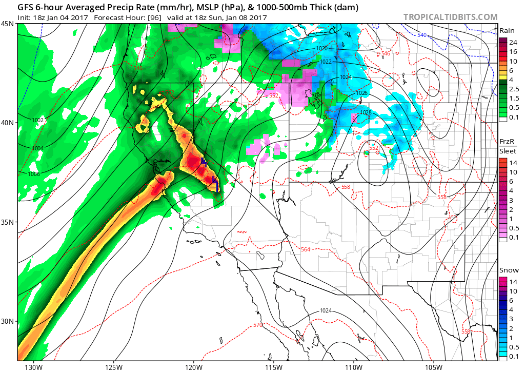
Weekend weather map showing far more rain than snow for California.
One additional concern with this storm is its subtropical origins. It’ll be bringing relatively warm air to California. This means snow levels will be quite high on Sunday—perhaps as high as 9,000 or 10,000 feet—so precipitation will fall as rain rather than snow even in the mountains. Which could potentially amplify the risk of flooding.
This system isn’t expected to produce significant impacts in Southern California as it’s aimed several hundred miles further north. There’ll still be rain in the Los Angeles basin but it probably won’t be heavy enough to produce flooding. (Though stronger storms are possible in Southern California later next week.)
Why are atmospheric rivers so important to California?
California has a globally unusual “Mediterranean” climate—meaning that it has a winter “wet season” and a sharply defined summer “dry season.” Even during the wet season, precipitation typically comes over the course of a few short, sharp bursts associated with atmospheric rivers. Just a handful of atmospheric river storms can bring a large fraction, or even a majority, of California’s total annual precipitation. As a result, atmospheric rivers play a critically important role in supplying water to ecosystems, agricultural zones, and urban areas.
What are the hazards associated with atmospheric rivers?
The majority of atmospheric river events in California bring more benefits than harm. But they can cause extremely heavy precipitation under certain conditions, especially along the coastal mountains and on the western slopes of the Sierra Nevada. When this occurs, flooding of rivers and streams—in addition to landslides and “debris flows” in regions of steep terrain—can cause substantial risk to human life and damage to property. Historically, the majority of major flood events along the west coast of North America result from atmospheric river storms making landfall.
Are atmospheric rivers changing as a result of global warming?
This question is still an active area of scientific research, but early indications do suggest that atmospheric rivers in some regions (including California) will probably become more intense in the future and produce more precipitation as the atmosphere warms. This doesn’t necessarily mean California will become much wetter overall, because there’s also evidence that any increase in atmospheric rivers may be counterbalanced by an increased number of dry spells. Ultimately, more research is still needed to better understand how these critical components of California climate may change in response to global warming.
Why did I come to UCLA to research this?
I’m collaborating with the Center for Climate Science to better understand changing precipitation extremes in California. The center is already trying to determine how global warming will affect the Sierra Nevada snowpack.
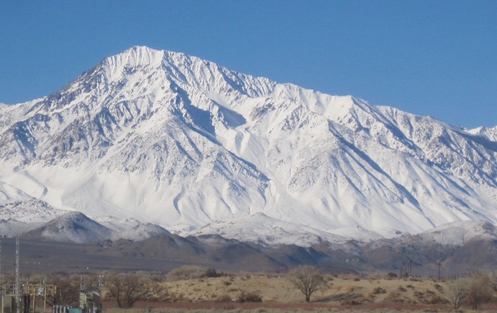 Mount Tom’s current snowpack. Sierra Nevada, east California. Photo credit, Jeff Holmquist, IoES White Mountain Research Center. January 6th 2017.