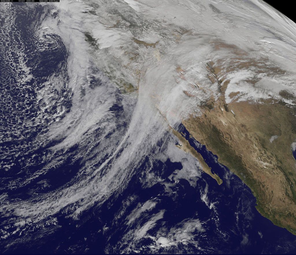
In the Future of Extreme Precipitation in California Project, researchers at the UCLA Center for Climate Science are investigating the effects of climate change on heavy precipitation events in the state. Specifically, our team is focusing on atmospheric rivers, moisture-laden filaments of air that move across oceans and can produce heavy precipitation when they make landfall. Forming over the Pacific and traveling east (often called the “Pineapple Express” when formed near Hawaii), California’s atmospheric rivers are responsible for most of the state’s heavy rains and mountain snowfall.
Context
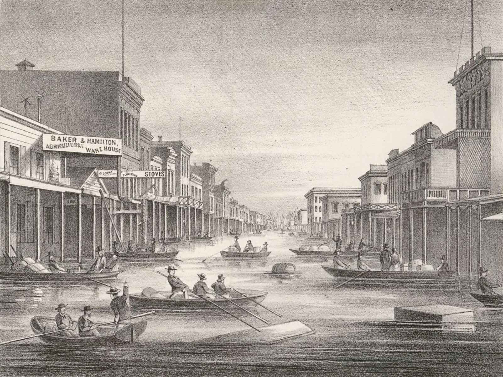
In California’s Mediterranean climate, the lion’s share of the precipitation that feeds our water supply falls in a short wet season between November and March – and it typically comes in a handful of intense storms. Because of this, the state’s reservoirs and other water infrastructure serve two purposes: To capture water for later use, and to prevent flooding downstream whenever possible. Each year, water managers perform a tricky balancing act. The system needs to collect enough water to supply users throughout the long dry season, while keeping space in reservoirs to catch heavy flows before they cause flooding.
Climate change promises to make managing California’s water even more challenging. Projections from global climate models — the computer simulation tools that inform the Intergovernmental Panel on Climate Change’s scientific assessments — lead us to expect that future precipitation in California will change. However, it’s unlikely the biggest change will be in overall amount of precipitation the state gets. Instead, it’s currently thought the character of precipitation will probably change, with more intense atmospheric rivers and longer dry spells between them. In other words, California’s already variable climate may become even more extreme.
For water managers to be able to plan for these changes, we need to better understand how they will play out in California. That understanding starts with answering questions about how climate change will affect the intensity, frequency, and seasonality of atmospheric rivers.
The scientific challenge
Global climate models are the best tools scientists have for simulating future climate, and they provide a wealth of information about climate change on the global scale. But when it comes to evaluating the regional details of climate change, they aren’t always the best tool for the job. This is especially true with respect to atmospheric rivers, since global climate models operate at very large spatial scales, and some of the factors contributing to the intensity of precipitation events tend to be localized.
The breakthrough
With a powerful combination of expertise in global and regional climate modeling, the global hydrologic cycle, and regional atmospheric dynamics, the project team is uniquely equipped to analyze atmospheric rivers in global climate model simulations — and importantly, to understand the physical reasons for changes in atmospheric rivers. In addition, the Center has pioneered techniques for creating highly detailed, physically realistic climate change projections from global climate model output. The team will use that expertise to quantify changes to heavy precipitation on the local scales that are most relevant to water resource managers.
Key results
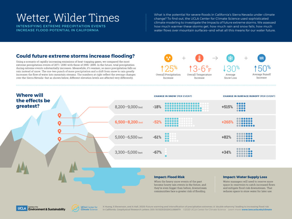
Future extreme storms bring increased flooding potential.
What is the potential for severe floods in California’s Sierra Nevada under climate change? To find out, we used sophisticated climate modeling to investigate the impacts of future extreme storms. We assessed how much warmer these storms get, how much rain and snow falls, how much water flows over mountain surfaces—and what all this means for our water future. Lead author Xingying Huang’s findings are published in Geophysical Research Letters.
California’s most extreme precipitation events will get more intense.
Atmospheric rivers are essential to California’s water story, and understanding their future under human-caused climate change is key to water resources and flood control planning. Until now, climate models have provided a murky picture of these extreme storm systems. At UCLA, we’ve developed a method to simulate future atmospheric rivers at a high level of spatial detail, and these projections show that under a scenario of rapidly increasing greenhouse gas emissions, the wettest storms will get even wetter. Learn more on coauthor Daniel Swain’s Weather West Blog, or find the paper in Science Advances.

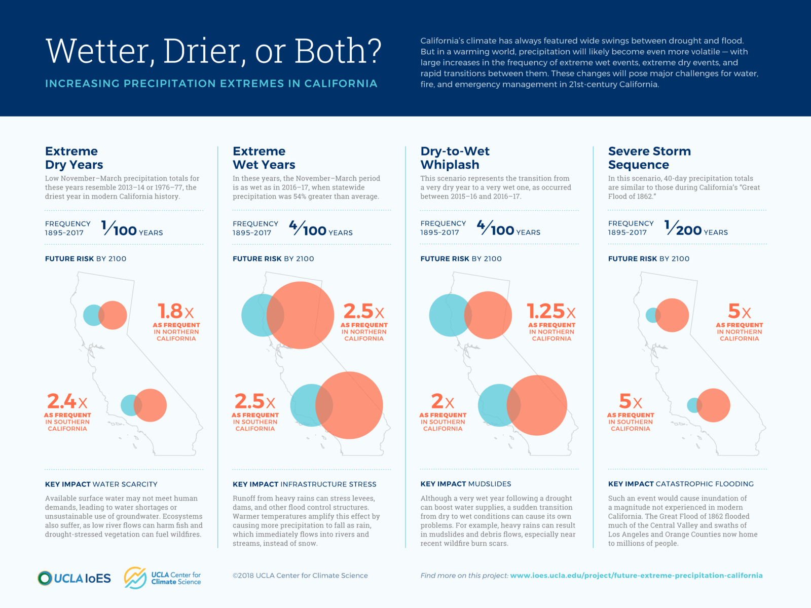
We can expect more wet and dry extremes in the future.
Under a scenario of rapidly increasing greenhouse gas concentrations, extremely dry and extremely wet events become more common over the course of this century. So do rapid transitions between very dry and very wet years. Learn more on lead author Daniel Swain’s Weather West blog, or check out the paper in Nature Climate Change.
More about the project
This project is funded by the UCLA’s Sustainable LA Grand Challenge, a campus-wide research effort to enable Los Angeles to rely on local water and renewable energy while protecting our region’s biodiversity. Additional support comes from the Nature Conservancy’s NatureNet Science Fellows program and the US Department of Energy Regional and Global Climate Modeling program.
Related Publications